Home
Home Download
 News
News Mastodon
 Bluesky
 X
X Summary - 17 Years
 Summary - 16 Years
 Summary - 15 Years
 Summary - 13 Years
 Summary - 11 Years
 Summary - 10 Years
 Resources
 Technical Reference
 Scripting Tutorial
 Video Tutorials
 Wiki Pages
 Image Gallery
 Color Presets
 Using libgmic
 G'MIC Online
 Community
 Discussion Forum (Pixls.us)
 GimpChat
 IRC
IRC Report Issue
| Table of Contents ▸ List of Commands ▸ Features Extraction ▸ minimal_path | ◀ min_patch | mse ▶ |
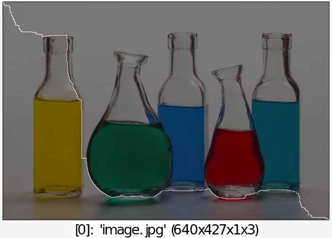
minimal_path
Arguments:
- x0[%]>=0,y0[%]>=0,z0[%]>=0,x1[%]>=0,y1[%]>=0,z1[%]>=0,_is_high_connectivity={ 0:No | 1:Yes }
Description:
Compute minimal path between two points on selected potential maps.Default values:
is_high_connectivity=0.
Example of use:
image.jpg +gradient_norm fill[-1] 1/(1+i) minimal_path[-1] 0,0,0,100%,100%,0 pointcloud[-1] 0 *[-1] 280 to_rgb[-1] ri[-1] [-2],0 or